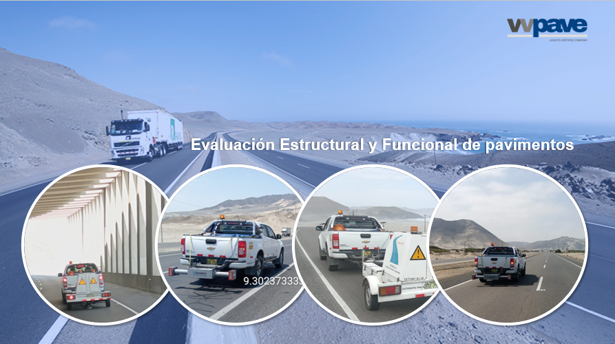
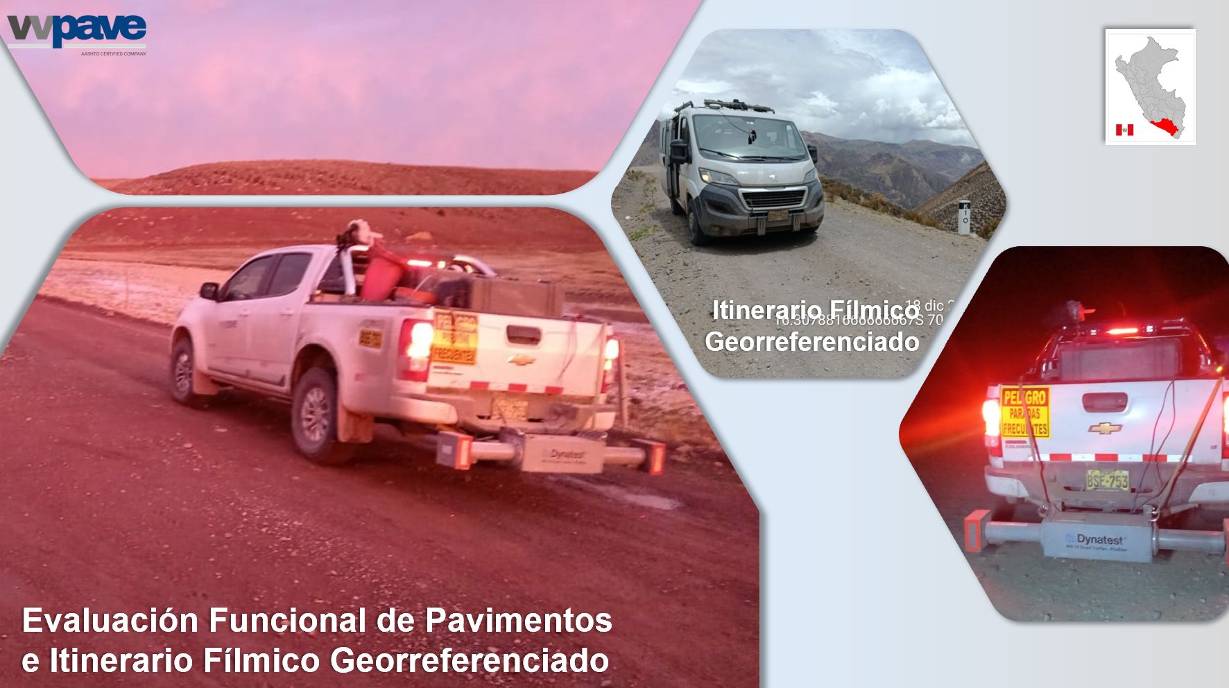
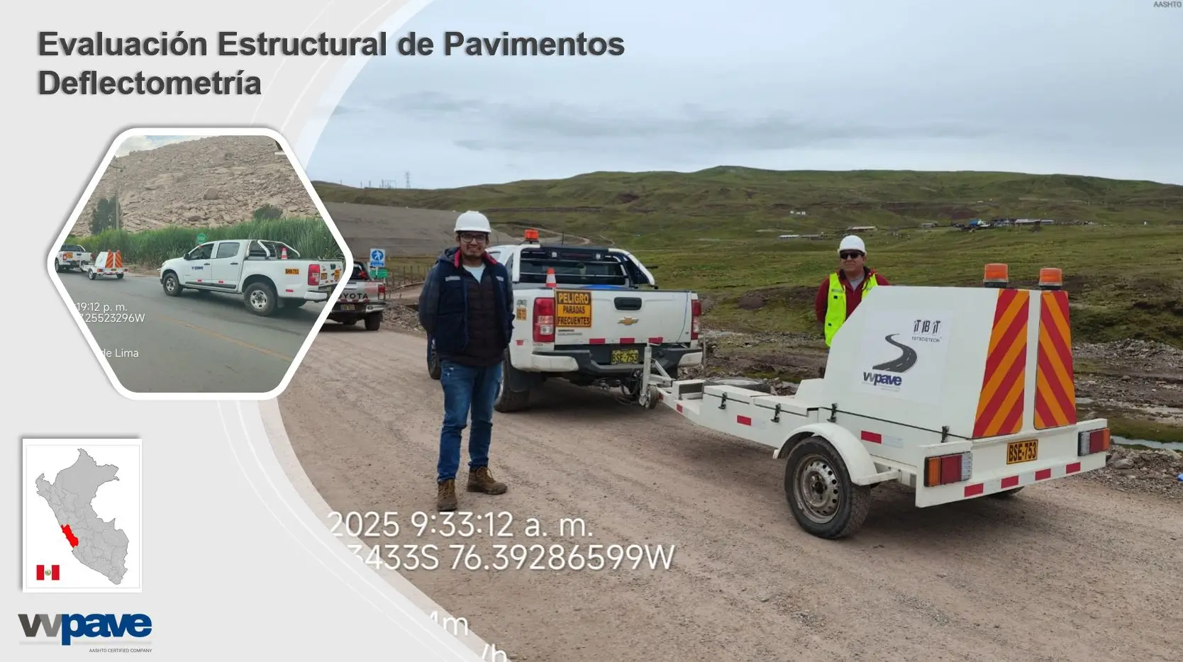
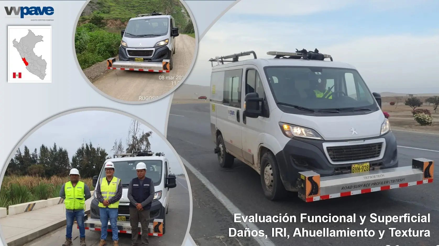
We combine structural, functional, surface, road safety, qualified inventory, and video itinerary evaluations to obtain a complete view of roadway condition.
We provide specialized support to the contractor or executing entity during the road construction phase, ensuring technical and contractual compliance in accordance with national regulations.
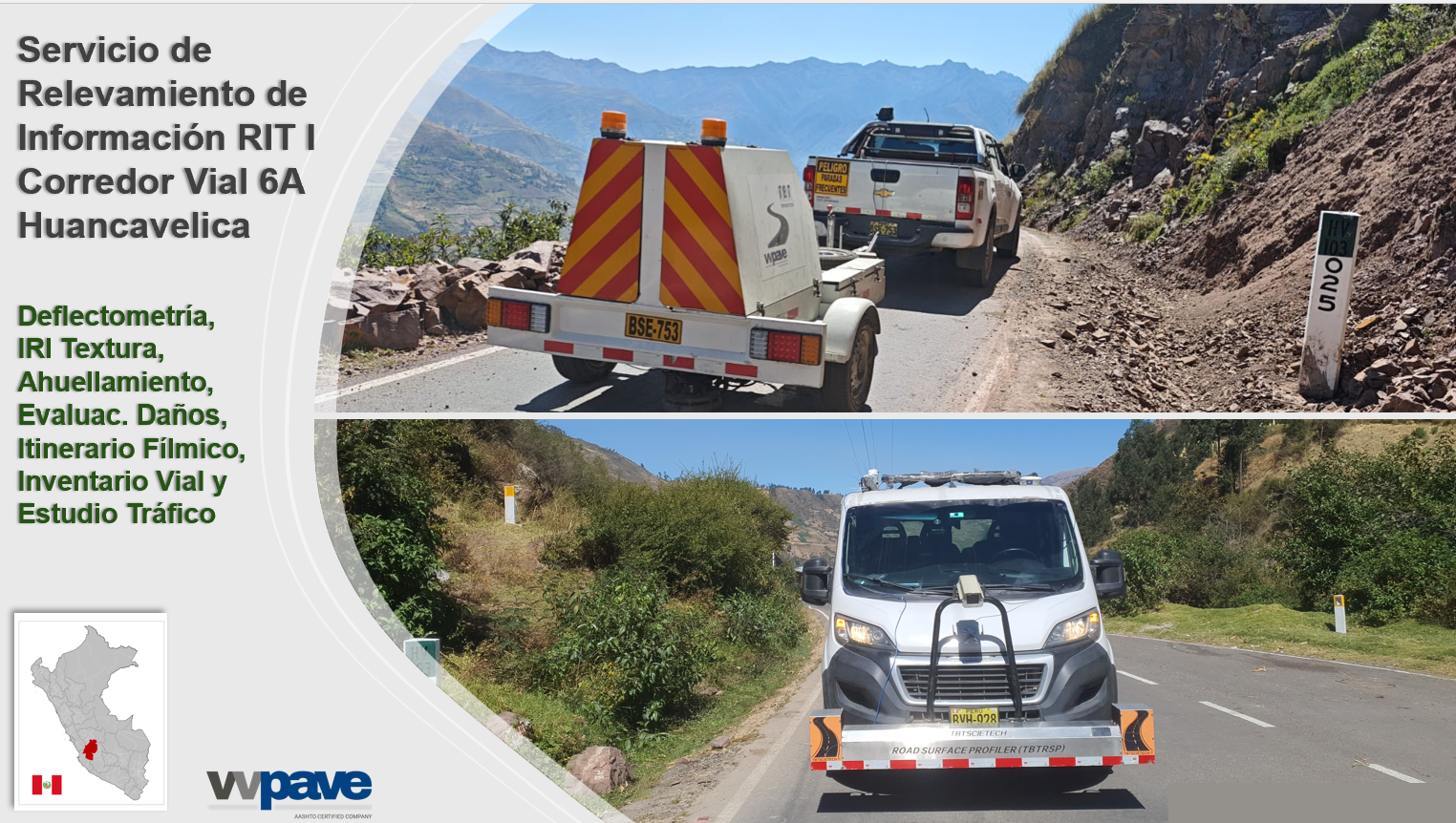
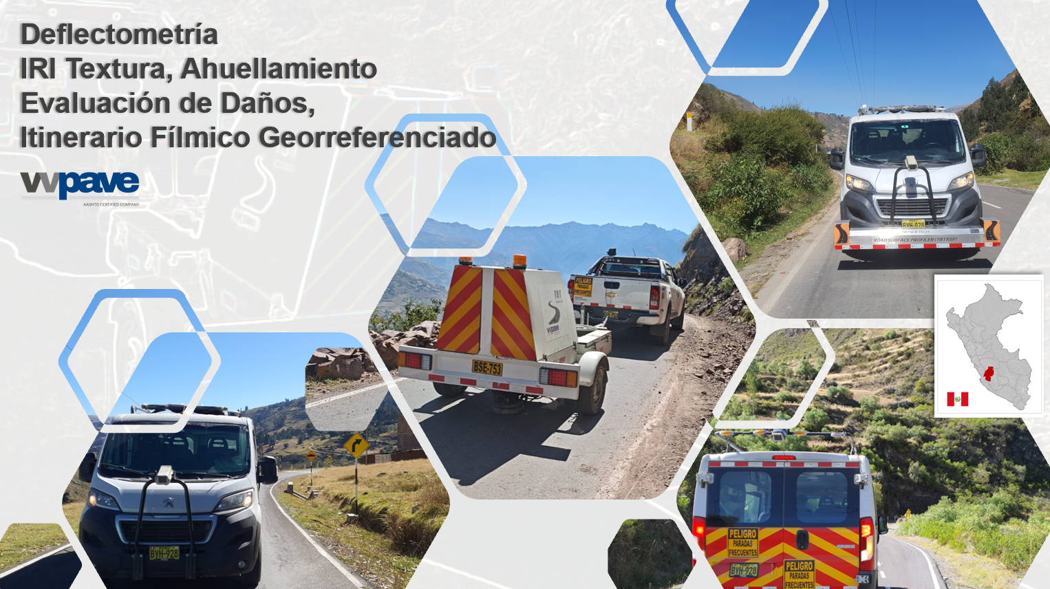
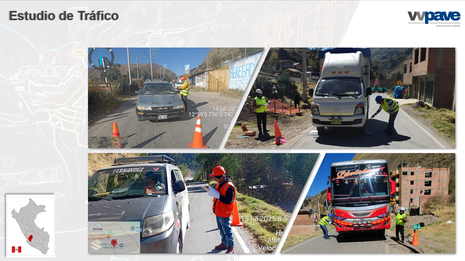
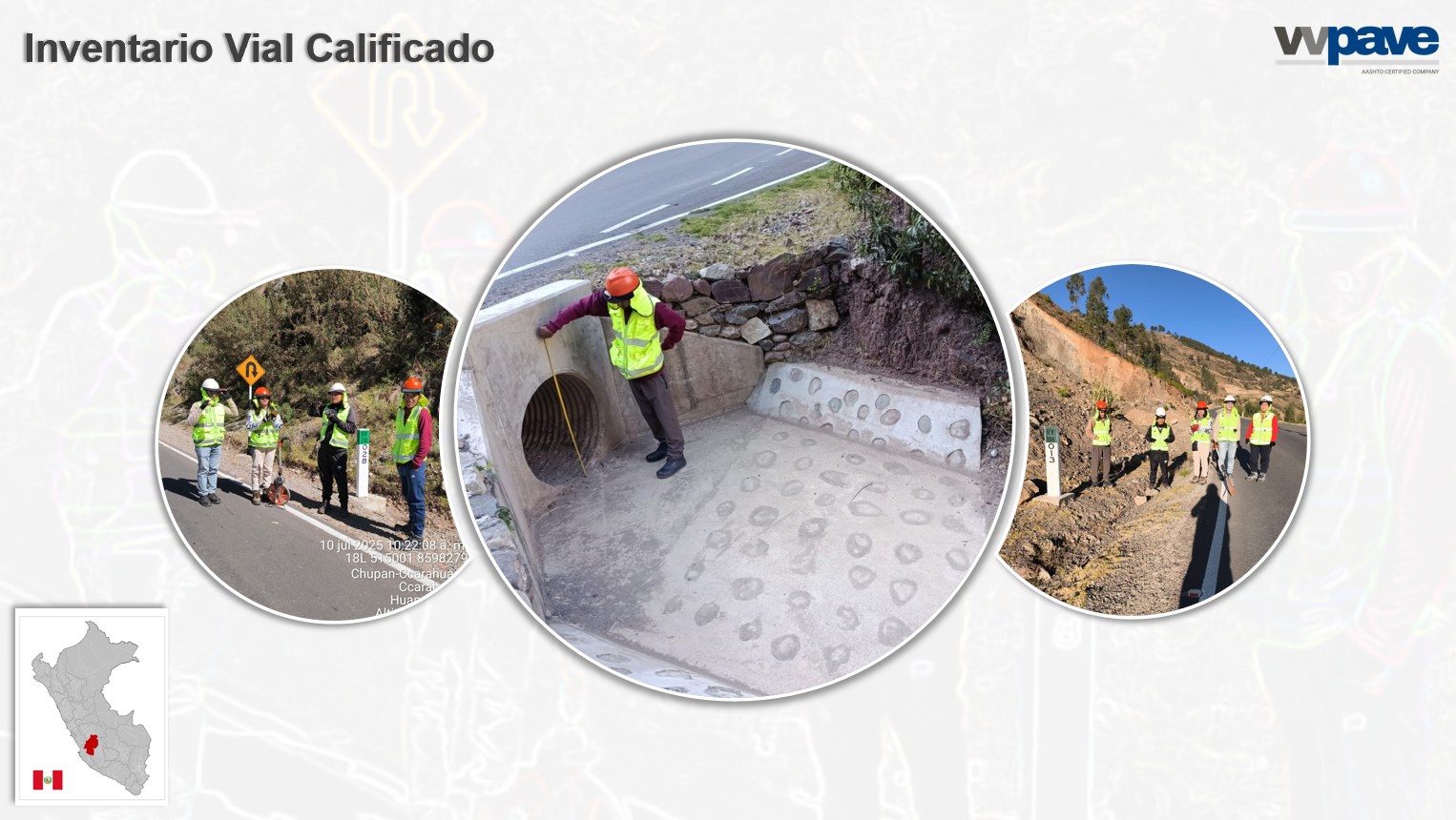
VVPave carried out the Final Type I Survey (RIT-1) of Road Corridor 6A in Huancavelica, covering 195 km of evaluated network. The work included FWD, IRI, texture, and surface distress measurements; qualified road inventory; a GIS project; as well as traffic studies and georeferenced video recording.
The result was a complete technical baseline for the diagnosis, planning, and monitoring of regional road preservation. Our technical capability and experience ensure precise and auditable results for public entities and concessionaires.
CONVISUNO – Comprehensive Evaluation of 284 km (2025)
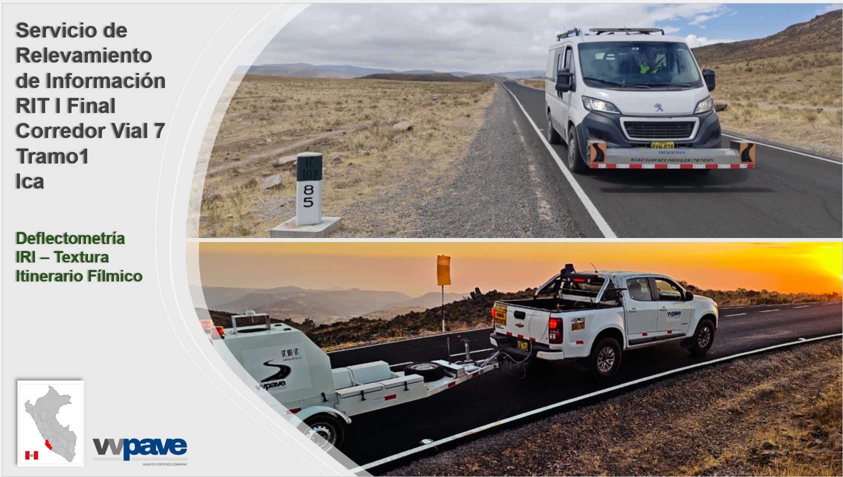
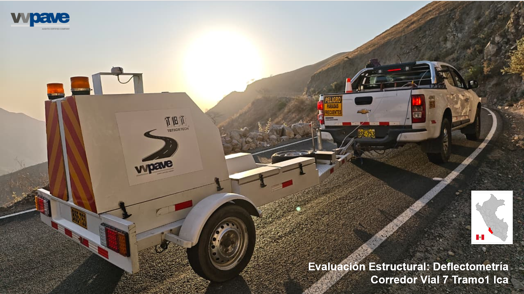
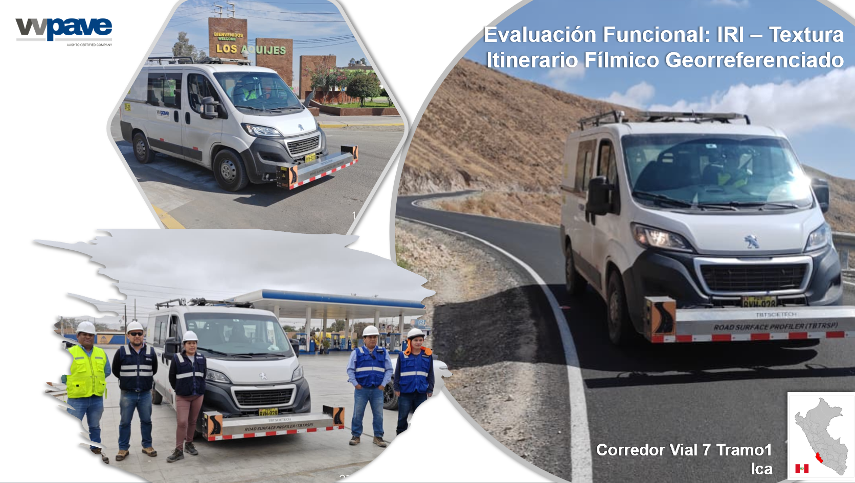
VVPave carried out the Structural, Functional, and Surface Evaluation of 284 km of Road Corridor No. 7, Section 1. The activities included: FWD deflectometry to determine structural capacity; IRI and texture measurements to assess comfort and safety; and georeferenced video recording of the route.
The study made it possible to identify critical sections and define preventive and periodic maintenance strategies, ensuring safe and long-lasting roadways.
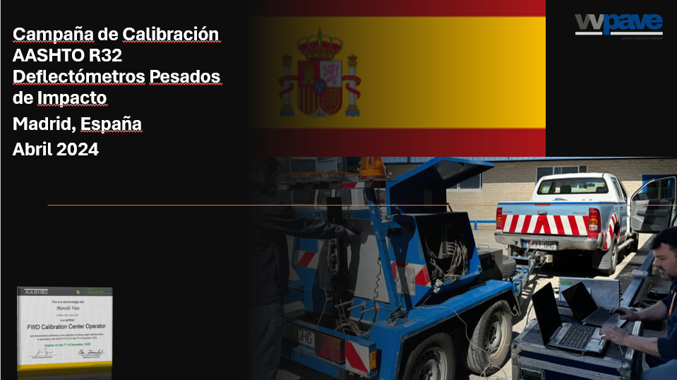
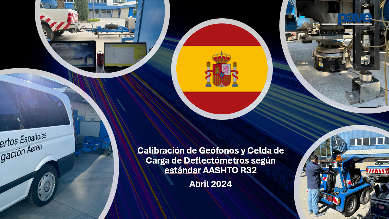
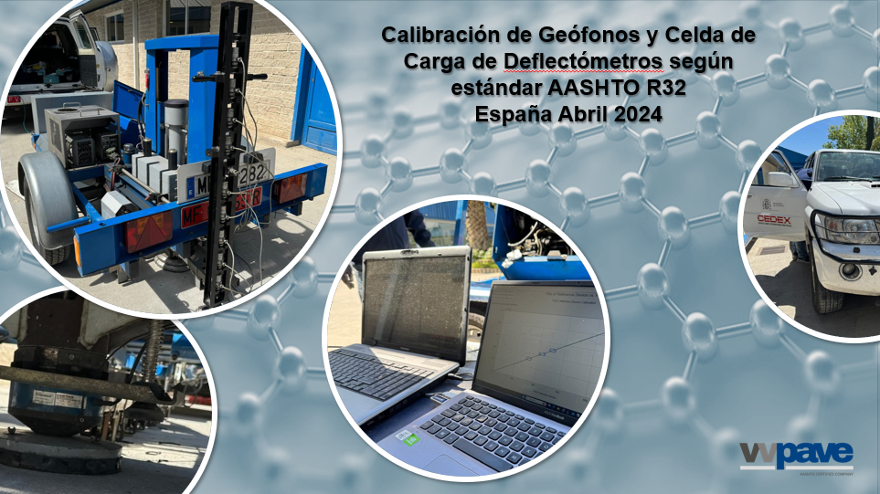
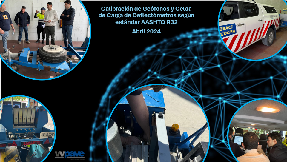
EUROCONSULT Spain – AASHTO R32 Calibration of HWD and FWD Equipment (2024)
VVPave carried out the AASHTO R32 Calibration of five HWD units and one FWD unit in Spain, belonging to Euroconsult, AENA, CEDEX, and other institutions. The service included comprehensive inspection, maintenance, operator training, and international certification.
This experience reinforces our global leadership as a Latin American benchmark in AASHTO calibration of pavement testing equipment, highlighting the technical quality and commitment of our certified personnel.
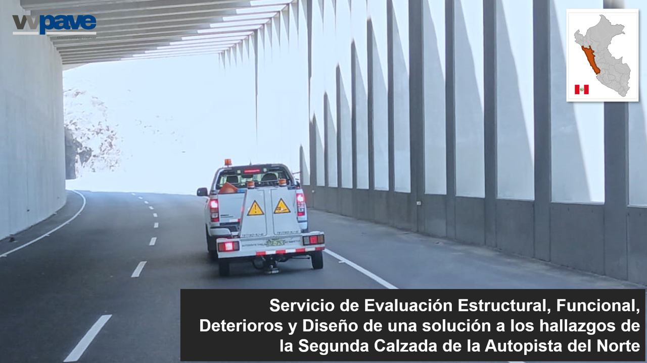
AUTOPISTA DEL NORTE – Second Carriageway Evaluation (2024)
VVPave carried out the Structural, Functional, and Distress Evaluation Service for 348 lane-kilometers of the Second Carriageway of the Autopista del Norte (AUNOR). The activities included FWD measurements, laser profilometer surveying, distress recording, and technical design of corrective solutions. The results supported investment and maintenance decisions for one of the country’s most important roadways.
Our participation reaffirms the trust of concessionaires in consulting services backed by our own equipment and multidisciplinary analysis.
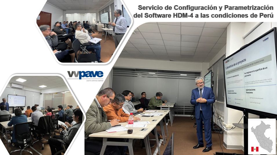
PROVIAS NACIONAL – Configuration and Parameterization of the HDM-4 Software for Peru’s conditions (2024)
VVPave was awarded by Provías Nacional for the Service of Configuration and Parameterization of the HDM-4 Software under local traffic, climate, and topographic conditions. This project included the provision of official licenses, technology transfer, and training for the entity’s technical personnel.
The result strengthens life-cycle–based planning and the technical prioritization of interventions for the non-concessioned National Road Network.
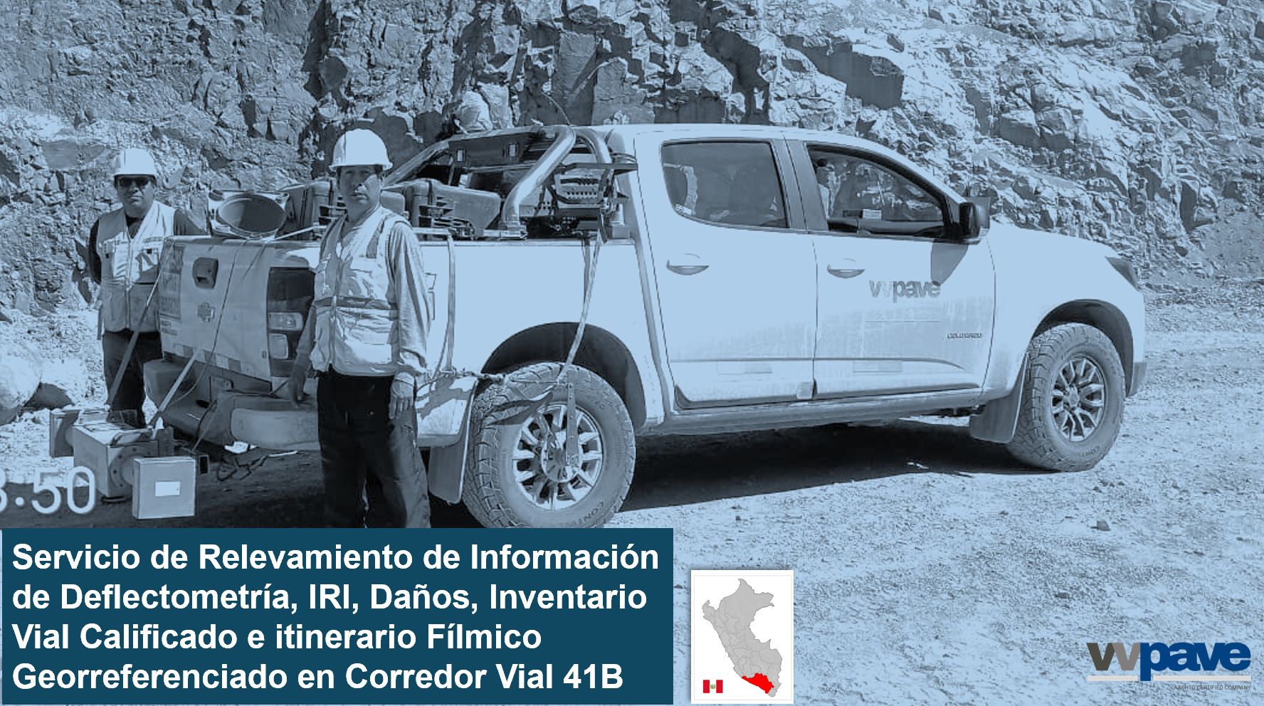
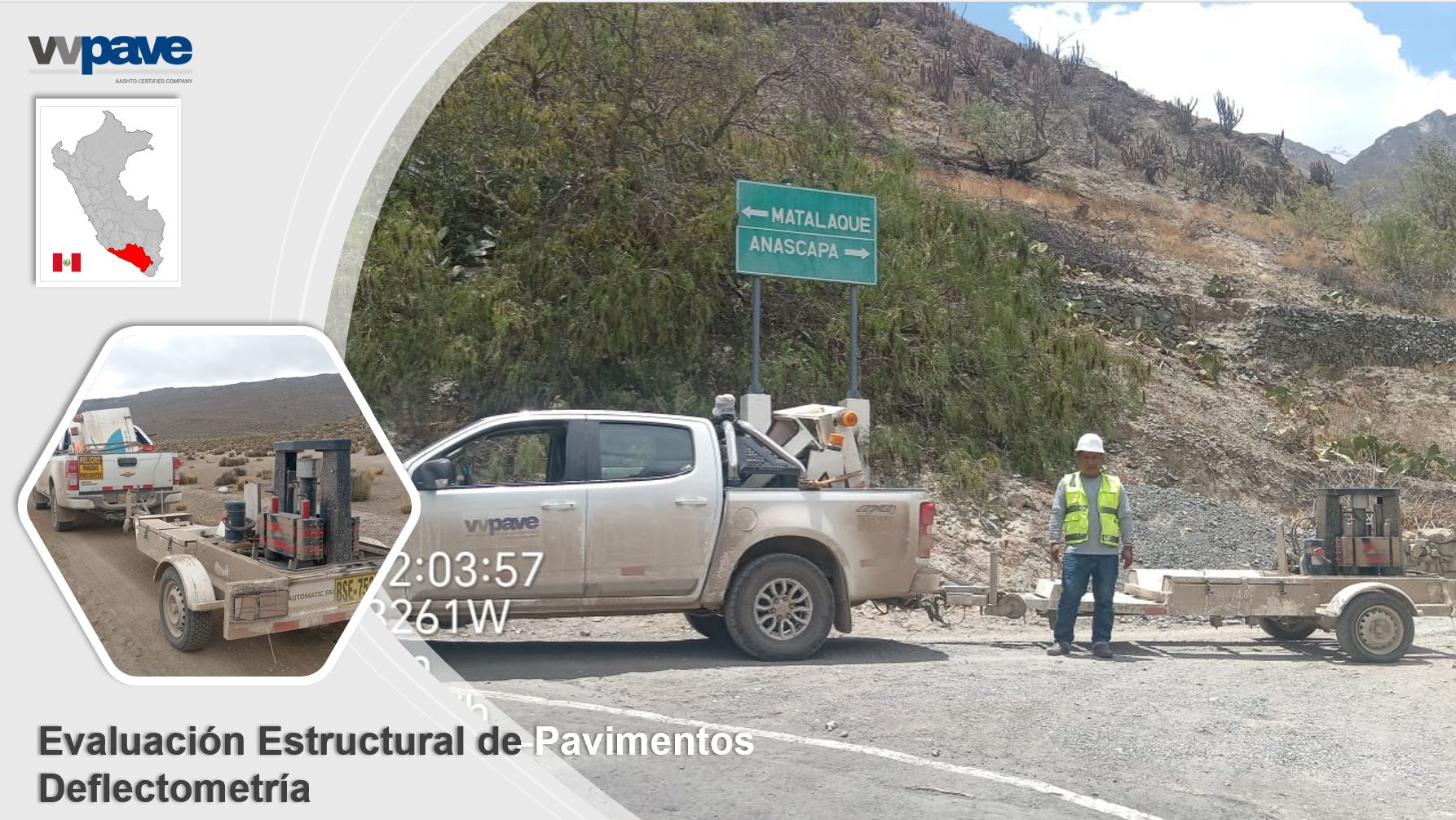
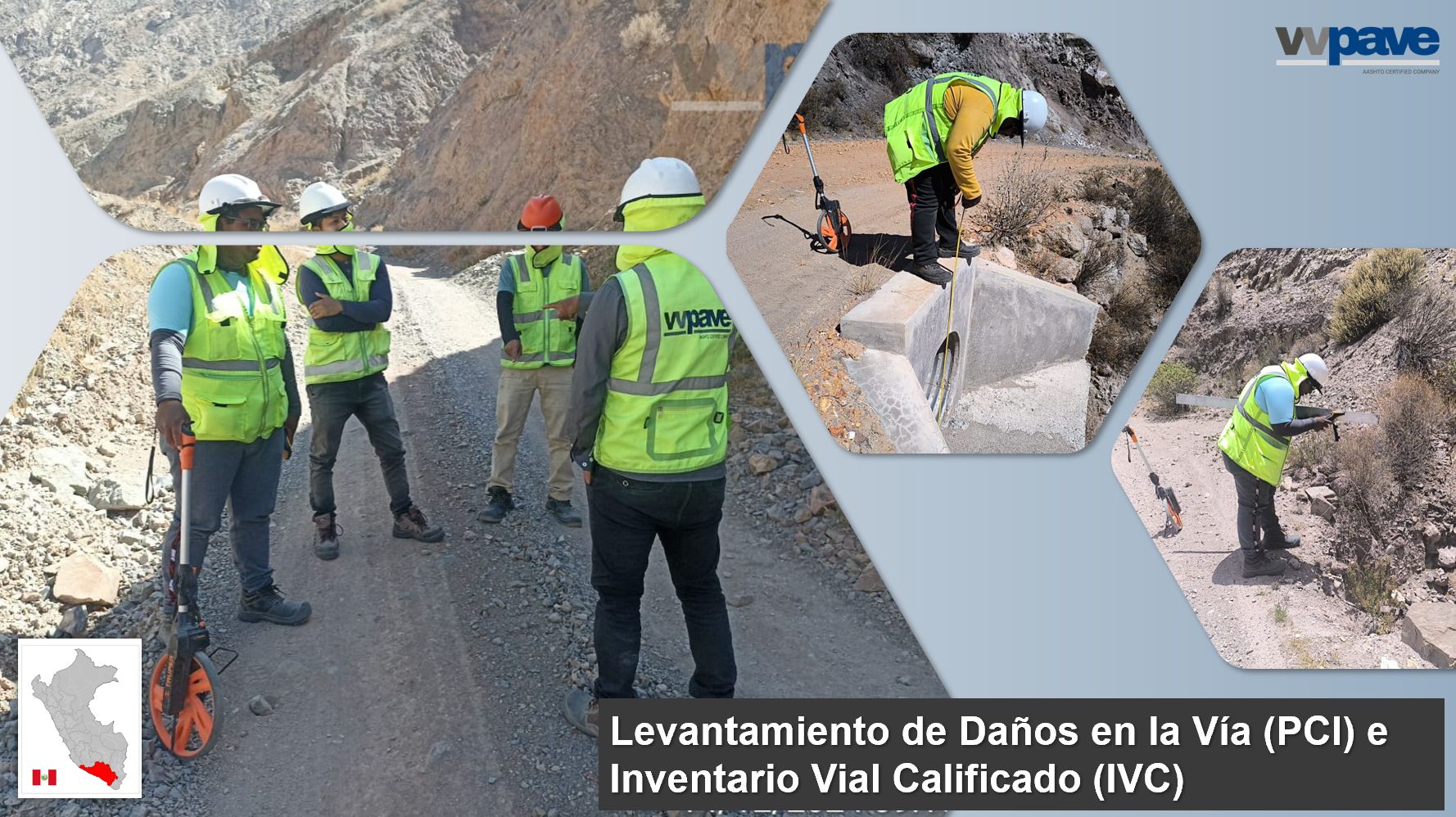
INGEMA – Evaluation and GIS Project (2024)
In partnership with INGEMA, VVPave carried out the structural, functional, and surface evaluation of Sector 41B (Moquegua–Arequipa–Puno), applying cutting-edge methodologies: AASHTO R32–calibrated FWD, laser profilometer for IRI and texture, distress surveying (PCI–EvalPav), Georeferenced Video Itinerary, Qualified Road Inventory, and a GIS Project.
This comprehensive approach provided the client with a visual and interactive road management tool, facilitating decision-making and budget prioritization.
CONSERVIAL – Comprehensive Evaluation of 252 km (2025)
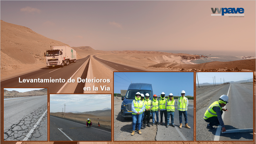
VVPave carried out the Structural, Functional, and Surface Evaluation of 252 km of the Emp. PE-18 – Sayán – Churín – Oyón – Huayllay corridor. The activities included: FWD deflectometry to determine structural capacity; IRI and texture measurements to assess comfort and safety; PCI surveying to diagnose distresses; and a GIS project for spatial representation and intervention prioritization.
The study made it possible to identify critical sections and define preventive and periodic maintenance strategies, ensuring safe and long-lasting roadways.
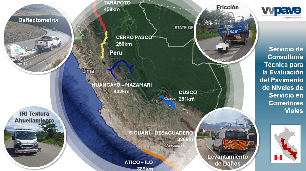
PROINVERSIÓN – Support for ProInversión’s Public-Private Partnership (PPP) initiative across six road corridors (2024)
VVPave carried out the Technical Consulting Service for Pavement Evaluation across six road corridors in Peru, covering more than 4,300 lane-kilometers. The project integrated simultaneous measurements of deflectometry (FWD), IRI, texture, friction, and automated surface evaluation, complemented by georeferenced video recording.
This evaluation made it possible to determine the condition of the pavement and design routine and periodic preservation strategies to improve road conditions.
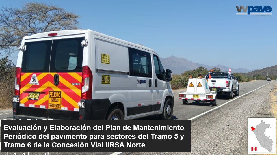
IIRSA NORTE – Development of the Periodic Maintenance Plan (2024)
VVPave carried out the Technical Consulting Service for Pavement Evaluation across six road corridors in Peru, covering more than 4,300 lane-kilometers. The project integrated simultaneous measurements of deflectometry (FWD), IRI, and automated surface evaluation, complemented by a traffic study and material source analysis.
This evaluation made it possible to determine the existing service levels and define conservation and periodic maintenance strategies projected over an 8-year period.